Maps that answer questions

Three services on display: live-registry resource mapping, expiring-ground intelligence, and satellite change detection — demonstrated across the Pilbara's mining landscape, from tenement registries to the iron ore pits themselves.

6,376
live tenements mapped
Live
WA government data
2019→24
mine change detection
By company
expiring ground surfaced

The tenement landscape, made legible

Every current mining tenement in the Pilbara — 6,376 of them — mapped from live Western Australian government registries with holder, status, grant date and legal area on every polygon. Click any piece of ground and know who controls it; click a company and see its entire position at once.
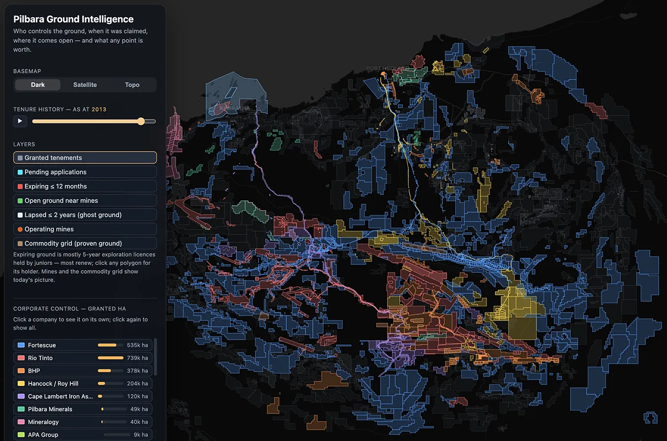
Pilbara tenure map with corporate control panel — Rio Tinto, Fortescue, BHP and Hancock holdings coloured across the region, with the tenure-history timeline set to 2013
Corporate control, coloured: Rio Tinto (739k ha), Fortescue (535k), BHP (378k), Hancock (204k) and the juniors — with the tenure-history timeline wound back to 2013.

The Ground Intelligence view goes a step further and asks the question explorers actually care about: which ground is coming free, and whose is it? Expiring exploration licences are surfaced company by company — most of it five-year exploration ground approaching its statutory limits — turning a registry nobody reads into a prospecting shortlist.
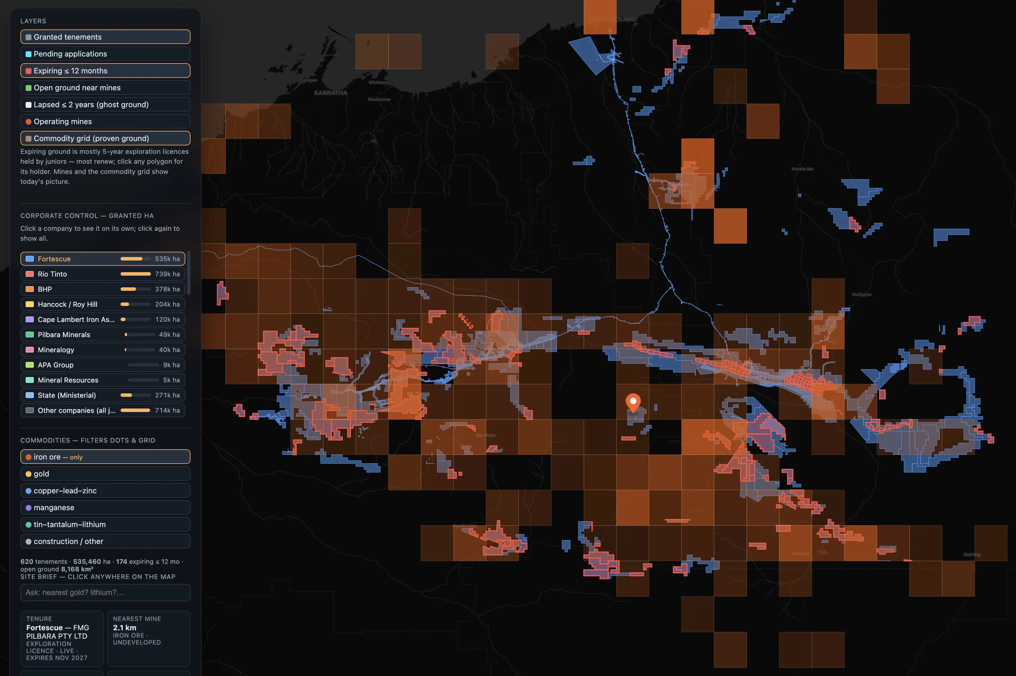

Pilbara Ground Intelligence site brief: Fortescue holdings filtered to iron ore, expiring tenements outlined, and a clicked point showing holder, licence expiry and nearest mine
The site brief in action: Fortescue's ground filtered to iron ore, expiring licences outlined, and one click answering who holds this point, when it expires, and how far to the nearest mine.

Watching the mines change

Satellite imagery pairs across the iron ore heartland, 2019 against 2024: pits deepening, waste dumps growing, new disturbance appearing. Change detection makes five years of operational history visible in one view — no site visit, no disclosure required, just what the ground itself records.

Satellite change detection across Pilbara iron ore mines between 2019 and 2024 — new disturbance and pit growth highlighted
Five years of mine evolution, 2019→2024 — growth and new disturbance highlighted across the iron ore operations.

Next: millimetre-scale ground monitoring

The Pilbara's dry, rocky terrain is close to ideal for radar interferometry — the same InSAR pipeline behind our Surat Basin & Southeast Queensland deformation map (11.2 million measurement points, GNSS-validated, every number traceable to its source acquisition). Applied here, it means millimetre-scale movement monitoring over pits, dumps, rail and tailings storage facilities — the assets where ground stability is the licence to operate.